How did I end up here? I am lying with my back down on Santa Maria volcano, surrounded by bushes and therefore hardly able to move. I am sweating like hell, finally giving my body a rest after several hours of climbing. And my mind is desperately racing to find an answer to the question how I can get out of here. Or whether I should call the rescue helicopter to try to get my out of this thorny situation…
Overconfidence could be a Dutch substantive. In the morning, around 7AM, I had even ignored the chicken bus to take me to the base of the volcano. Instead I walked from my AirBnB in Xela to the suburb of Llano de Pinal. A nice one-hour warm-up couldn’t hurt, would it?
Research
In the days before I had extensively researched the hike. According to several blogs, the climb up was definitely manageable without a guide. Being Dutch also means being stingy. So I decided against a trekking company. Besides that, I prefer to set my own pace. I made sure to take plenty of sandwiches, water and layers of clothes with me. What could possibly go wrong?
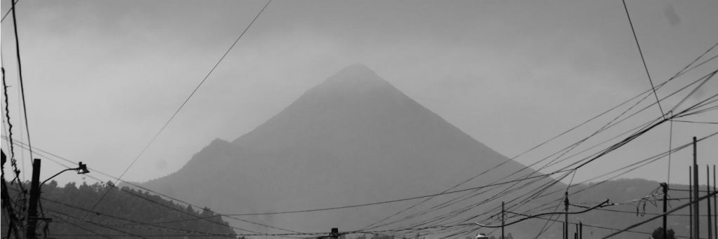
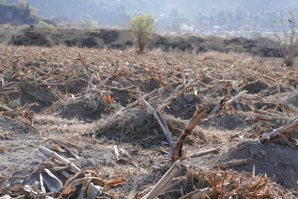
Santa Maria lies in the middle of Guatemalan volcano heartland. From its top you can see several of the other highest summits in Guatemala, including big brother Acatenango. But for that hike a night in a tent on the mountain is required, so I preferred Santa Maria instead as a warm-up for my three-day hike from Xela to Lake Atitlan. Corn field between Xela and Pinal, Guatemala
Volcano trail
Well, the ascent definitely was a main meal and not a starter. Getting to the village of Pinal was relaxed enough, enjoying the magnificent early sunlight over the corn fields. The suburb basically has one main street, which blends onto a dirt track. And, yes, there was the only sign I noticed that pointed towards the volcano trail. If only they had had one or two more of those…
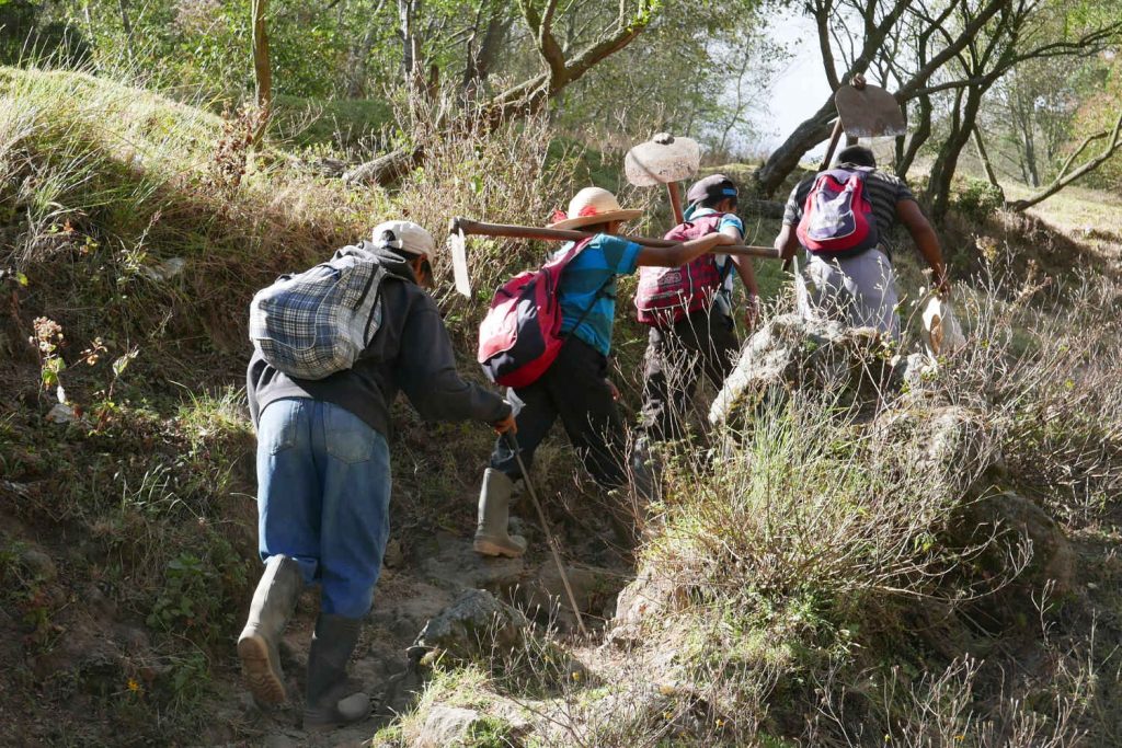
Going in the dry season definitely made the first third pleasurable. You meet some local farmers climbing to their fields, joining you on the grassy path which is sometimes steep, sometimes less so. After around 800 metres the path slowly splits in a grassy side (to the right) and a more rocky path to the left. My otherwise reliable map app didn’t show this, so this is the first opportunity I took to go wrong. And I think I succeeded all three times.
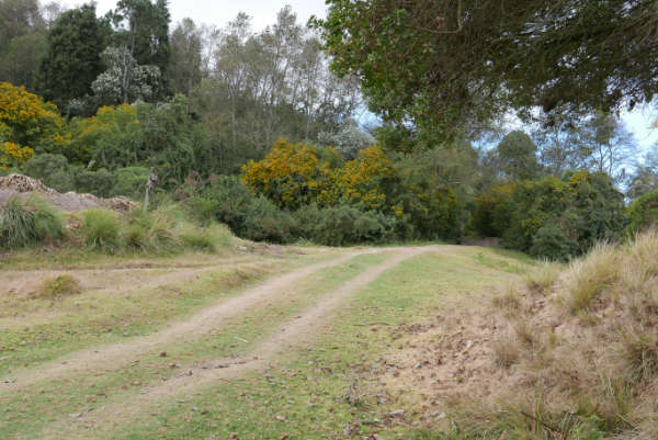
Now, the first two mistakes weren’t so bad. Because when you continue the grassy path, you will get to a meadow after around fifteen minutes. This is where you should turn left immediately, across the meadow, where soon enough you will find the proper path. Of course I went straight on, climbed for fifteen minutes on a narrow trail, before I hit a closed gate. Hm, back to the meadow, and up the correct path!
Farmers climbing volcano Santa Maria in Xela
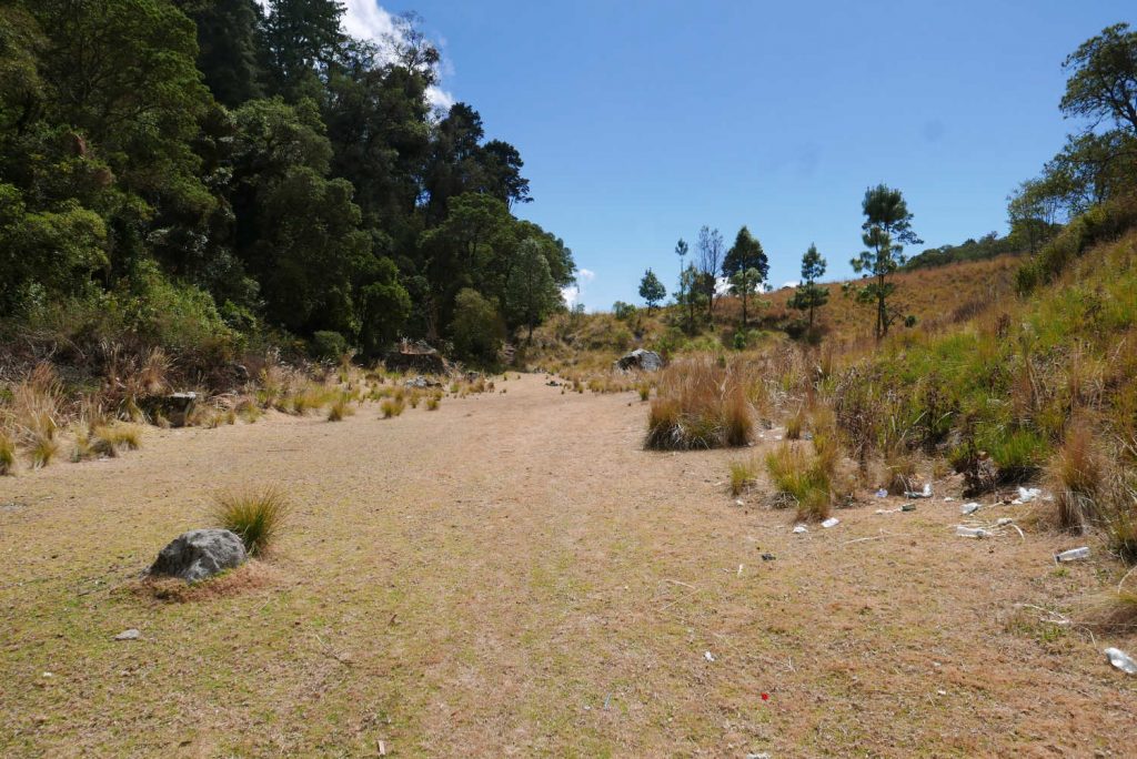
The first meadow. Go straight on for the wrong direction…. better turn left!
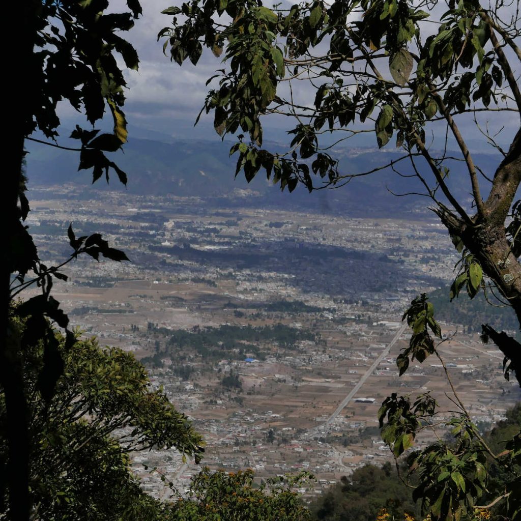
Panorama view of Xela from Santa Maria volcano
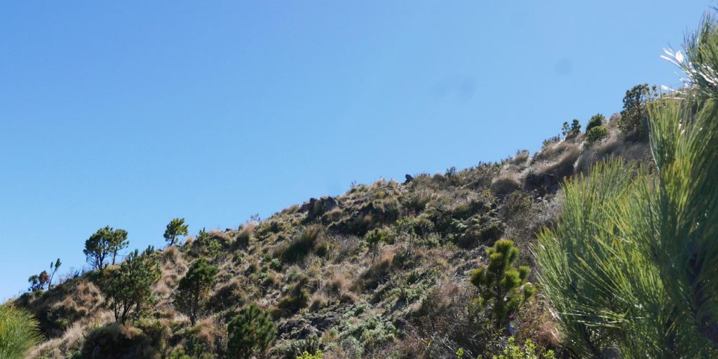
The rocky last stretch towards the summit of Santa Maria volcano
The meadow
Always keep up the good spirit, right? So yes, after a solid climb I reached the La Meseta clearing. It’s a beautiful, yellow-golden meadow. It’s a good place to have a rest before you start the proper ascent of Santa Maria, because you have only reached the one-third point. Thank God I didn’t know that.
Now, this actually turned out to be the crucial stage of the walk. Because somewhere very early on the right side is the main path hidden. Follow your map app as close as you can, until you are very confident it is a solid path upwards. La Meseta meadow, the crucial stretch of the Santa Maria volcano hike
This is, of course, where I went wrong (and also lots of other people, I found out later during my trek to Lake Atitlan). Basically I crossed the meadow for 200-300 metres and turned to the first path I noticed. Which looked, initially, good though a bit narrow. Until there is no discernible path anymore. You end up in thick bush. You check your app and know you are only hundred metres away from the proper trail.
But there is just no way to get there! So you end up cursing yourself, hurting yourself at plants, bushes and trees on the steep mountain. Until you get exhausted and take the best decision you can in such a situation.
Which means: calm down, get a rest, take some food to keep the energy level up. And after eliminating the nightmare scenarios (calling the emergency troops, having to sleep in the bushes during the cold night, etc), opt for the most logical scenario. Which meant: let yourself glide/fall through the bushes down the mountain, to at least find the narrow path. It might be the wrong one, but it would at least get me down to La Meseta. And then of course go straight down to Xela, surrendering to the mountain, not taking any unnecessary risks anymore.
Rambo
Panorama view of Xela from Santa Maria volcanoRelief, my friends, is an understatement to describe the feelings after finding the small trail back down after five minutes or so grinding through the tree branches. At least I knew I was going to get home today, back in my bed. Which is more than I could have dreamed of only a quarter of an hour before. I didn’t even care I looked like Sylvester Stallone in the first Rambo movie at this stage.
So, straight back down? Nope, because the Gods of cynicism decided to have a laugh with me today. Not even two minutes later I hit upon a wider path. And a lot of hikers. Hallelujah, the proper trail! And it can’t be that far anymore, right?
Gorgeous viewpoints
Ha! The best was yet to come… two to three hours through the steepest part of the climb. Expect loads of rocky steps, hardly any flat stretches, and gorgeous lookout points to admire the views of the (smaller and smaller) Xela valley. The thinner air started to kick in at this height. But the knowledge of being close to the tree line, and thus the summit, kept me going.
No, I didn’t make it all the way to the 3,722 metres high summit. After reaching the tree line I opted to enjoy the astonishing views. Grab a bite. And save some energy by not going to the top, but going straight down. Finally a sensible decision 🙂
View from volcano Santa Maria near Xela, Guatemala
Surreal
Going down proved to be more dangerous than going up, because of sliding rocks and slippery sand. The indigenous women doing a praying ritual in a circle for an injured member of the crew (sprained ankle) will be forever etched in my memory. Their wonderful singing, in the middle of the forest, was surreal.
Just as surreal as reaching Pinal again after a mere two hours of descending Santa Maria. As by magic – and a rare can of Coca Cola – energy returned to my body and confidence to my mind. One more chicken bus to take me to Xela, to enjoy the memories that are always sweeter than the act itself.
Practical information:
How to get there: either walk to Llano de Pinal, or take a chicken bus (around 2 Quetzales one way) early in the morning (between 6am and 7am). The bus goes past Iglesia El Calvario (at the Cemetario Central), then onwards to the Minerva terminal before returning to Pinal. Takes ages by the way
Length: 5-7 hours from the village
Equipment:
Food and drinks (at least two litres, preferrably more)
Walking pole
Several layers of clothes (the top is around 1,500 metres higher than Xela)
Cap and sunglasses
Rain gear
first aid kit (optional)
Navigation: download the Maps.me app before the hike. Look up the way to Santa Maria before the trip and download it, so you are not reliant on cell phone reception
Good to know:
If you need guides, Quetzaltrekkers is a good option. I opted for them as well on my hike to Lake Atitlan
Safety has improved over the years. There are sometimes police patrols on the trail and summit as well. Use common sense though
Sleeping at the summit is allowed. Bring your own tent. The main reason to do that is to have night and early morning views of Santiaguito, a nearby lava dome. You can also make a detour there on your way back
Check the weather forecast before you leave. Cloudy weather makes it very likely you can forget about those awesome kick-ass views
The last big eruption of Santa Maria, albeit a catastrophic one, was in 1902. The volcano is still active
More information:
Experienced hiker Steve from In Shape Explorer writes about the walk to Santa Maria
To provide the best experiences, we use technologies like cookies to store and/or access device information. Consenting to these technologies will allow us to process data such as browsing behavior or unique IDs on this site. Not consenting or withdrawing consent, may adversely affect certain features and functions.